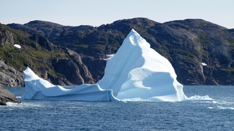
Sentinel-1 documents largest ice loss at Petermann Glacier since 2012
Satellite data show how on 4 August 2026 a roughly 76 km² section of the floating ice tongue of the Petermann Glacier broke off — …
Read moreCurrent, source-based articles – chronological and clearly presented.
Satellite data show how on 4 August 2026 a roughly 76 km² section of the floating ice tongue of the Petermann Glacier broke off — …
Read more
In July 2026, sea surface temperatures along Europe’s Atlantic coasts and in the western Mediterranean reached new highs, locally up to 6 °C above average. …
Read more
The Intergovernmental Panel on Climate Change (IPCC) has opened registration for the combined government and expert review of the Second-Order Draft of its methodology report …
Read more
More than 120 experts will meet from 11 to 14 August in Mexico City to advance the First Order Draft of the IPCC methodology report …
Read more
ESA satellite imagery reveals how extreme heat, drought and large fires alter landscapes and air. Remote sensing delivers near‑real‑time warnings and long-term time series for …
Read more
Copernicus Sentinel-2 images document exceptionally low water levels of the Danube north of Budapest. The pictures illustrate the consequences of the ongoing drought in Central …
Read more
On Brazil’s northern coast, glittering freshwater lakes form every year between white sand dunes. Satellite data reveal how rain, geology and coastal processes turn an …
Read more
The ESA selection from 3–7 August 2026 shows smoke plumes, parched landscapes, retreating sea ice and discolored oceans. The images deliver robust data for research, …
Read more
The European Space Agency and The Pokémon Company are planning a joint initiative for 4–10 October 2026. The aim is to engage young people with …
Read more
More than 100 researchers from 56 countries are meeting in Bhopal (3–7 August 2026) to refine the content and recommendations of the IPCC special report …
Read more
The ESA has completed commissioning of the two HydroGNSS Scout satellites. Free-to-use measurements of soil moisture, open water and snow are now available worldwide — …
Read more
After prolonged drought and repeated heat spells, forests are burning in southwestern France and in central and eastern Spain. An analysis by World Weather Attribution …
Read more
More than a month after the double earthquakes of 24 June 2026 in northern Venezuela, newly reprocessed Sentinel-1 radar data indicate stronger and more widespread …
Read more
The Copernicus Climate Change Service introduces CARRA2, a pan‑Arctic reanalysis at 2.5‑km resolution. The dataset begins in September 1985, will be updated monthly with low …
Read more
On 24 March 2026 a one‑day Copernicus training taught journalists how to handle climate and atmospheric data confidently. Data journalists worked with portals, Jupyter tutorials …
Read more
The ECMWF is calling for project proposals until 9 April 2026. New this year: an Africa-focused stream; the emphasis is on open source, visualization and …
Read more
At the 5th NCP Forum of the Copernicus Climate Change Service on 3 June 2026 in Budapest, national networks demonstrated how climate data can be …
Read more
In Rome, experts at an FAO- and IPCC-hosted meeting are debating how agriculture and food systems can become more resilient to growing climate risks while …
Read more